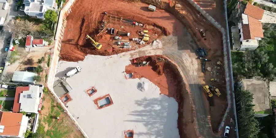
The most expensive mistake on a Providence jobsite isn't a delayed concrete pour — it's a blind excavation. Too many contractors assume the city's dense glacial till will hold a vertical cut through winter. Then a nor'easter hits. The saturated silt lenses between till layers lose suction, and a 20-foot wall slumps into the footing zone before the rebar cage even arrives. We've seen it on College Hill, where old fill overlies the till, and we've seen it downtown where the water table sits barely 8 feet below street grade. A proper geotechnical design of deep excavations maps these transitions before the first bucket breaks ground. That means interpreting SPT blow counts from the Rhode Island Department of Transportation borings, cross-checking with CPT test data to catch the soft seams that standard sampling misses, and modeling the staged excavation sequence with realistic groundwater assumptions — not textbook defaults. Providence doesn't forgive textbook defaults. The city's variable overburden, from Federal Hill's compact urban fill to the riverbank's organic silts, demands a site-specific approach. We deliver designs that keep the cut open, the utilities intact, and the adjacent 100-year-old foundations exactly where they belong.
Providence excavations fail at the interface between dense till and saturated silt — identifying that transition is the core of our design methodology.
Our approach and scope
Local considerations
The drill rig sits on Dorrance Street at 6 AM, a Diedrich D-120 or similar track-mounted unit, augering through the asphalt crust into Providence's urban fill. The operator watches the torque gauge — a sudden spike means a granite cobble, a sharp drop means the auger just punched into a void left by a collapsed 19th-century sewer. This is the reality of subsurface investigation downtown. The physical risk during deep excavation design isn't theoretical; it's the unrecorded utility trench filled with loose sand, the timber pile cluster from an old mill foundation, the abandoned oil tank that still holds product. Our field team logs the cuttings, compares them with historical Sanborn maps, and flags every anomaly before the shoring designer draws a single section. On the East Side, where narrow streets mean the excavation shoring sits within 3 feet of the property line, we specify real-time vibration monitoring and pre-construction condition surveys. The biggest risk is assuming the ground is uniform because the geotech report says "glacial till." It's not. The till in Providence is a heterogeneous mixture of silt, sand, and boulders — and it behaves differently on Angell Street than it does on Atwells Avenue.
Applicable standards
ASCE 7-22 Minimum Design Loads for Buildings and Other Structures, FHWA Geotechnical Engineering Circular No. 4: Ground Anchors and Anchored Systems (FHWA-IF-99-015), ASTM D1586 Standard Test Method for Standard Penetration Test (SPT) and Split-Barrel Sampling of Soils, ASTM D2487 Standard Practice for Classification of Soils for Engineering Purposes (Unified Soil Classification System), IBC 2021 Section 1807 Earth Retaining Structures
Related services
Shoring System Design
Complete design of soldier pile and lagging, sheet pile, secant pile, or diaphragm wall systems. Includes tieback and internal bracing layouts with detailed connection calculations.
Base Stability and Heave Analysis
Evaluation of excavation bottom stability against basal heave in soft clay layers and piping in granular soils, using Terzaghi and modified Navfac methods.
Groundwater Control and Dewatering Plans
Design of deep well, wellpoint, or eductor dewatering systems tailored to Providence's perched and tidal-influenced groundwater conditions.
Construction-Phase Instrumentation and Monitoring
Specification and interpretation of inclinometers, piezometers, crack gauges, and vibration monitors for risk management during excavation adjacent to sensitive structures.
Typical parameters
Quick answers
What is a typical cost range for the geotechnical design of a deep excavation in Providence?
Fees for the geotechnical design of deep excavations in Providence generally range from US$2,220 for a straightforward single-tier shoring up to US$7,980 for a complex multi-level tieback system with dewatering and instrumentation plans. The final fee depends on the depth of the cut, the proximity to adjacent structures, and the complexity of the groundwater control required.
How does Providence's glacial till affect deep excavation design?
The dense lodgment till provides excellent stand-up time and high friction angles, often exceeding 34 degrees. However, it contains lenses and layers of saturated silt and sand that can cause local instability and require supplemental dewatering or jet grouting. Our designs always account for this layered heterogeneity.
What documentation is required for the Providence building permit review?
The City of Providence Department of Inspection and Standards requires calculations sealed by a Rhode Island PE, signed and sealed construction drawings showing the shoring layout, and a geotechnical data report with all boring logs. If the excavation is deeper than 12 feet, a monitoring plan for adjacent properties is typically required.
How long does the design process take for a typical downtown excavation?
For a 25-foot-deep excavation in downtown Providence, the complete design process — from receipt of the geotechnical report to submission of sealed drawings — typically takes two to three weeks. Rush timelines can be accommodated if the subsurface data is already available.