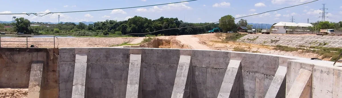
Providence packs a lot of geological variety into a small footprint. Dig on College Hill and you hit dense glacial till within a few feet; move down toward the Jewelry District or the 195 corridor parcels and you are working through thick sequences of urban fill, buried organics, and pulverized brick that shift settlement profiles completely. The same shoring design that holds a cut steady on the East Side can let a Fox Point excavation move more than the adjacent row house tolerates. For this reason, we tie every geotechnical excavation monitoring program to the specific stratigraphy of the block, not just the city. Before steel goes in the ground, we often correlate the planned cut with data from CPT soundings in loose fill zones and test pit logs where buried foundations are suspected, building a baseline that makes later movement readings meaningful.
The soil two blocks apart in Providence rarely behaves the same way — baseline readings before the first cut are what separate a controlled excavation from a reactive one.
Our approach and scope
Local considerations
Providence sits near the northern edge of the Narragansett Basin, so the subsurface often mixes Pennsylvania-age sedimentary rock with much younger glacial outwash and compressible estuarine silts. One number that matters: the depth to bedrock can jump from 15 feet to over 100 feet within a single city block, particularly near the buried river valleys that run beneath downtown. When an excavation stays in the overburden, the biggest risk is not collapse — it is the slow, cumulative movement that cracks century-old masonry party walls before anyone notices. Vibration is another variable on tight streets like Benefit or South Main, where a hoe ram working ledge rock transmits energy directly into adjacent foundations. A monitoring plan that covers both deformation and vibration, with thresholds keyed to pre-construction condition surveys, turns those risks from guesswork into manageable numbers. For deep urban cuts where wall stiffness is non-negotiable, we often recommend pairing the monitoring array with a deep excavation design review so the support system and the instrumentation are tuned to the same deformation criteria.
Applicable standards
ASTM D1586 – Standard Test Method for Standard Penetration Test (SPT) and Split-Barrel Sampling of Soils, ASTM D2487 – Standard Practice for Classification of Soils for Engineering Purposes (Unified Soil Classification System), IBC Chapter 33 – Safeguards During Construction (excavation and shoring provisions), ASCE 7 Section 19 – Geotechnical Monitoring Requirements for Seismic and Deformation Performance
Related services
Inclinometer & Tiltmeter Arrays
Grouted-in-place MEMS inclinometers along shoring walls with automated cloud logging; tiltmeters on adjacent structures where rotation tolerance is tight.
Settlement & Crack Monitoring
Optical survey points, crack gauges on neighboring buildings, and deep settlement pins to separate shallow fill compression from deeper consolidation.
Vibration & Noise Compliance
Triaxial geophones with real-time PPV alerts, calibrated to RI DEM and city ordinance limits, plus ambient noise baselines before rock hammering begins.
Typical parameters
Quick answers
What does geotechnical excavation monitoring cost for a typical Providence mid-rise project?
For a Providence excavation lasting two to four months, monitoring programs generally range from US$910 to US$2,880 per month depending on the number of instruments, read frequency, and whether automated or manual collection is specified. A basic array with inclinometers, settlement points, and weekly reports sits at the lower end; adding real-time vibration stations, automated data loggers, and daily engineering review moves toward the upper end.
Which Providence neighborhoods trigger the strictest monitoring requirements?
The Jewelry District and the historic mill overlay zones along the Woonasquatucket usually require the tightest deformation limits because of unreinforced masonry construction and shared party walls. College Hill projects face added scrutiny for vibration near institutional buildings, while the 195 redevelopment parcels often carry groundwater-related monitoring conditions due to the buried river channels.
How early should monitoring instrumentation go in before an excavation starts in Providence?
Inclinometer casings and settlement points should be installed and baselined at least one to two weeks before the first cut. This window captures ambient conditions — traffic vibration, seasonal groundwater levels, thermal movement — so that construction-related changes are distinguishable from background noise when the excavation begins.